
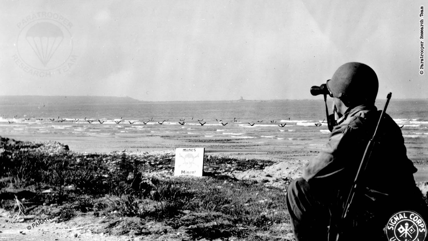
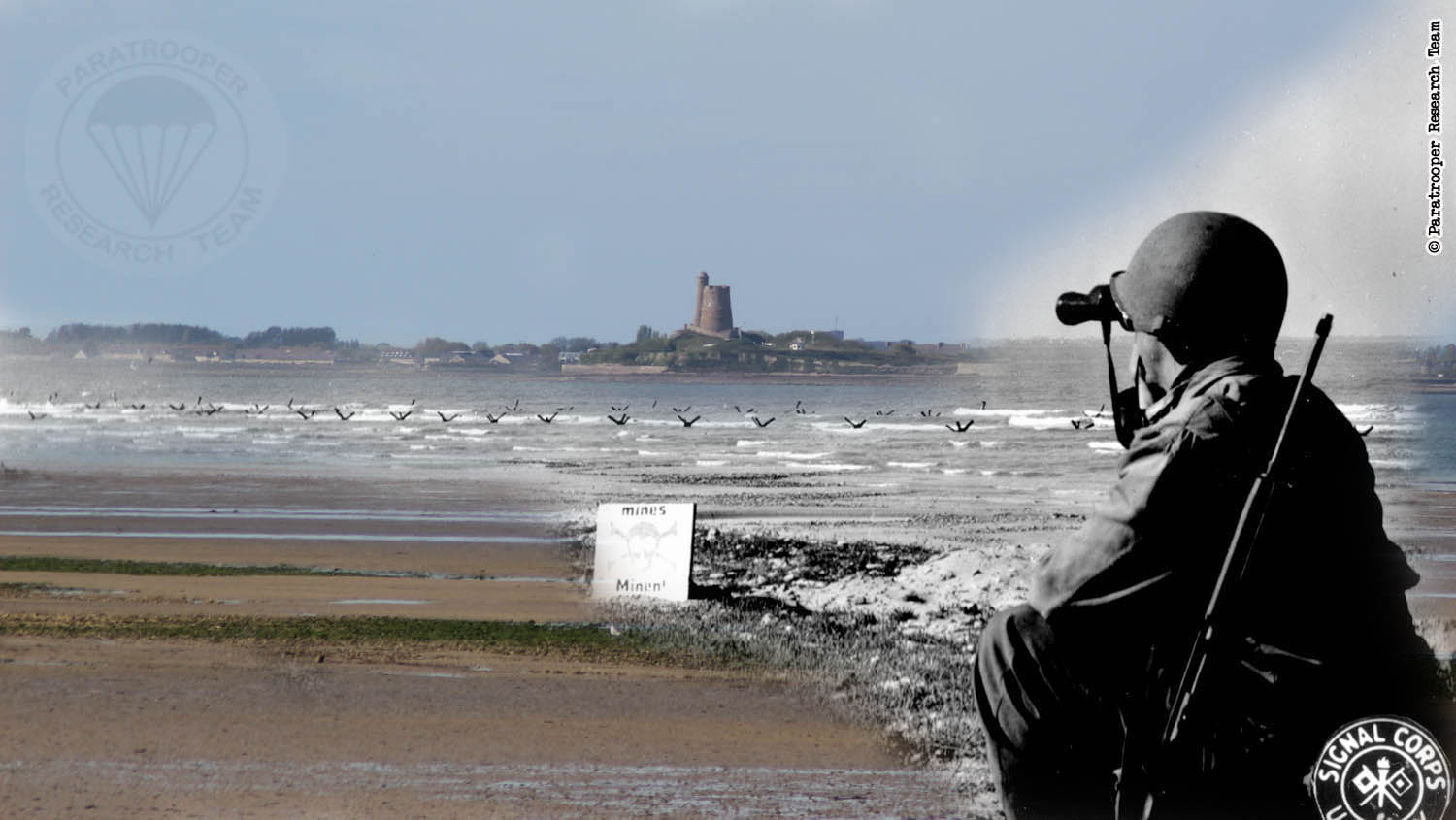
A favorite WWII photograph of ours: GI looking in the direction of Saint-Vaast-La-Hougue. The beach still mined and obstacles in the shallows.
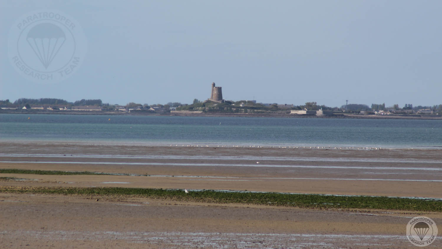
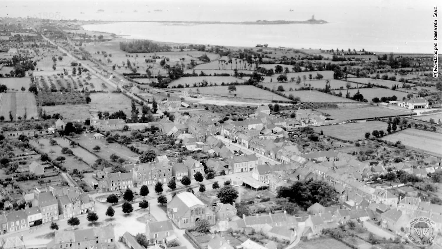
A slightly different angle, but you will get the general idea: 300mm zoom image of the peninsula, and the strech of land beyond it (St-Vaast and Tatihou Island - which has it's own tower!).
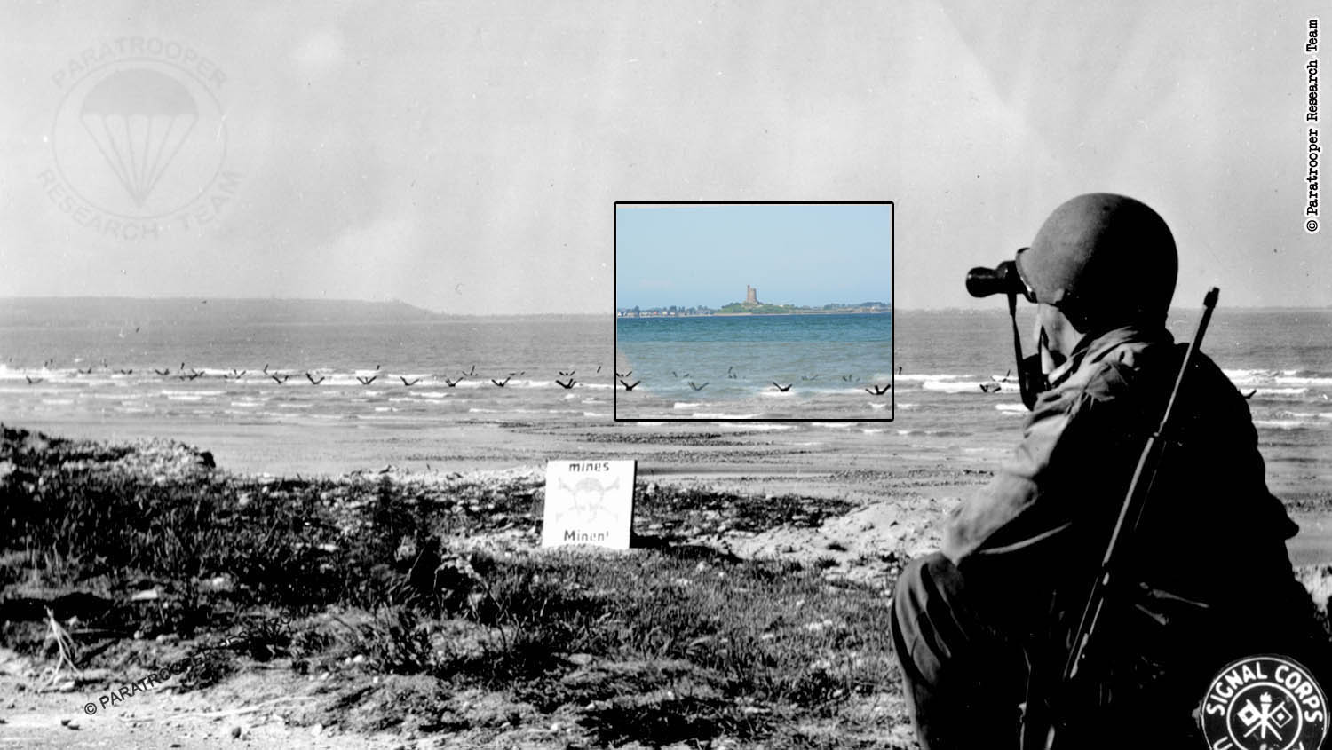
Then and Now Ghosts of History...
Aerial photograph of the Saint-Vaast peninsula.
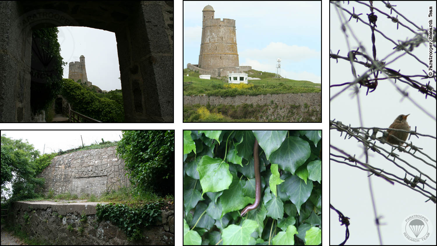
You can actually hike around the seawall and the tower. It is still connected to WWII history, although wildlife has taken over again...

© Paratrooper Research Team - Normandy 2023 - Saint-Vaast-La-Hougue - Then & Now